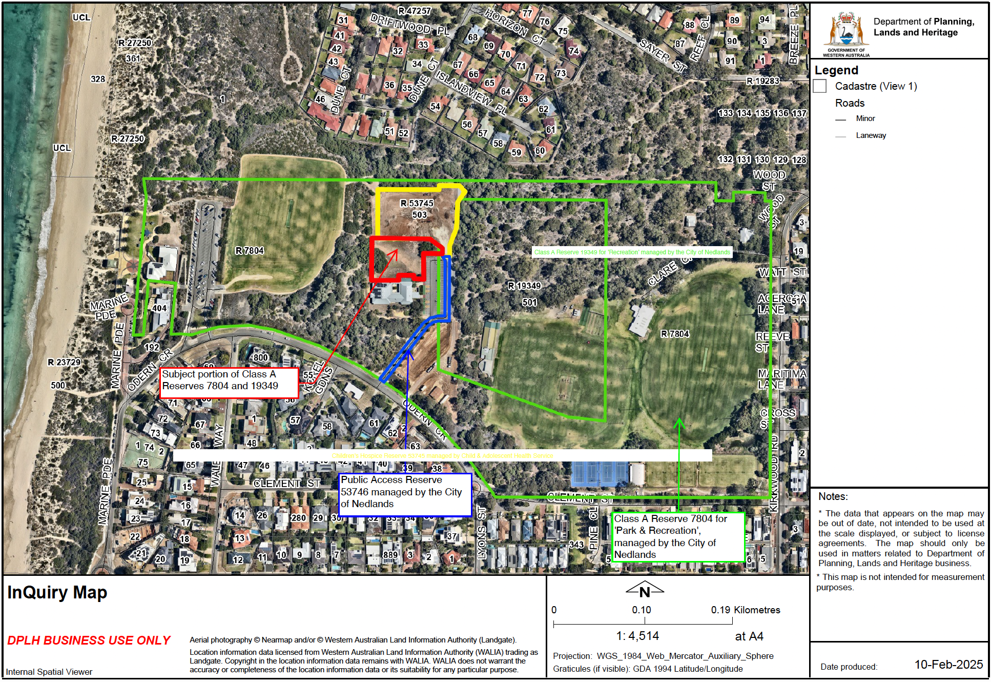
Map of proposed excision area
This map has been provided by the Department for Planning, Lands and Heritage, however it is only an INDICATION of the area the Minister for Planning and Lands proposes to remove from Class A reserves in Allen Park.
As a survey has not been carried out, it is unknown exactly what portion of the land is under threat.
At this stage it is approximated to be at least 3,000 square metres, which is all the land between the southern boundary of the hospice site and the northern boundary of the WA Bridge Club.
The area shown in RED on the adjacent map.